
Ashley Whitlock
Hampshire & IOW Butterflies and Moths

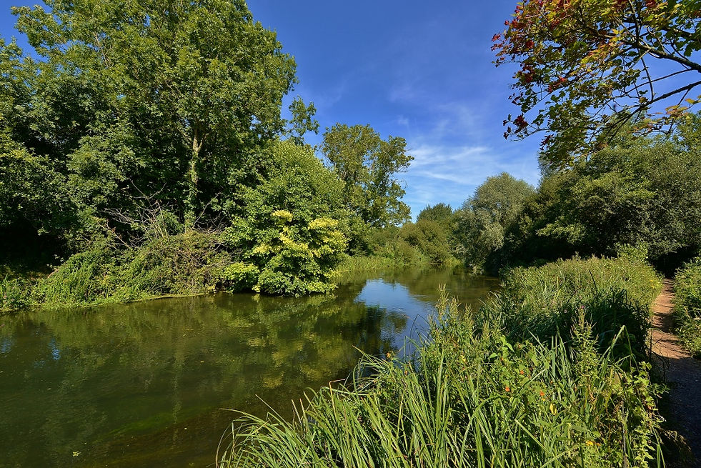
St Catherines Hill Down and the River Itchen

.jpg)


The Brown Argus butterfly is a very common species in and around the site. Other butterflies worth looking out for is Adonis Blue, and Silver Spotted Skipper.
In the river Itchen the Water Vole can be seen in the tributeries if you are extremely lucky

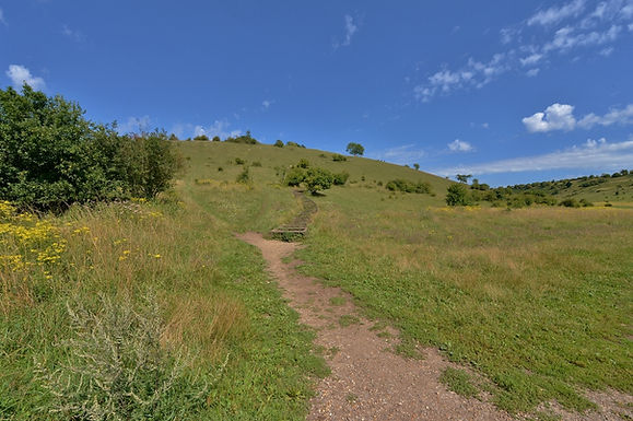
A dramatic 220ft climb up St Catherine’s Hill’s wooden stairs reveals show stopping views of Winchester city, as well as the Itchen Valley floodplains and the downland it nestles in. At the summit are the earthworks of an Iron Age fort, buried ruins of the Norman chapel that gives the site its name, and a copse of beech trees. In the summer you’ll be able to hear the cackle of a woodpecker, Red Kites, buzzards and kestrels hunting in the valley below, and meet our friendly British White cattle that graze the site to encourage wildlife to flourish.
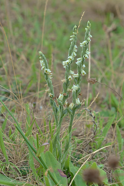
On the way down look out for some of the 25 species of breeding butterfly that call it home, including Chalkhill blues, brown arguses and marbled whites. Keen eyed visitors might also spot some of the rarer orchids dotted across the hill’s slopes and meadows, including musk orchids, frog orchids and autumn lady’s tresses. St Catherine’s Hill is a fabulous place to enjoy a summer walk.
St. Catherine's Hill is a 43-hectare (110-acre) biological Site of Special Scientific Interest on the outskirts of Winchester in Hampshire. It is managed by Hampshire and Isle of Wight Wildlife Trust and most of it is an Iron Age hillfort, which is a Scheduled Monument.
The top of the hill is ringed by the ramparts of an Iron Age hill fort. In the centre a copse of beech trees contains the site of the 12th-century chapel of St. Catherine. There is also a mizmaze, probably cut between 1647 and 1710.
The River Itchen in Hampshire, England, rises to the south of New Alresford and flows 26 miles (42 km) to meet Southampton Water below the Itchen Bridge. The Itchen Navigation was constructed in the late 17th and early 18th centuries to enable barges to reach Winchester from Southampton Docks, but ceased to operate in the mid-19th century and is largely abandoned today.
The river is one of the world's premier chalk streams for fly fishing, amenable to dry fly or nymphing. The local chalk aquifer has excellent storage and filtration and the river has long been used for drinking water. Watercress thrives in its upper reaches.
Much of the river from its source to Swaythling is classified as a 748.5-hectare (1,850-acre) biological Site of Special Scientific Interest (SSSI), and a Special Area of Conservation, of which the 9-hectare (22-acre) Hockley Meadows nature reserve is a part. The Itchen estuary is part of the separate Lee-on-The Solent to Itchen Estuary SSSI.
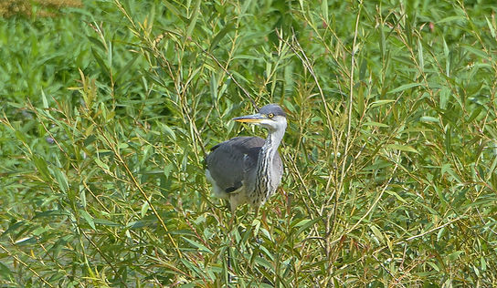
The SSSI covers the river and its banks, with fen, flood meadows, wet woodland and swamp. It has populations of the nationally rare southern damselfly and white-clawed crayfish. Other fauna include otters, water voles, Atlantic salmon, shovelers and Cetti's warblers.


St Catherines Hill Down is very close to the City of Winchester so its hardly surprising that the odd Purple Emperor record turns up there and at Magdellan Hill Down a few miles away. Winchester is probably the most Purple City in Hampshire if not the UK so its worth looking out for it especially in and around the tree lines and along hedgerows where its foodplant sallow grows.